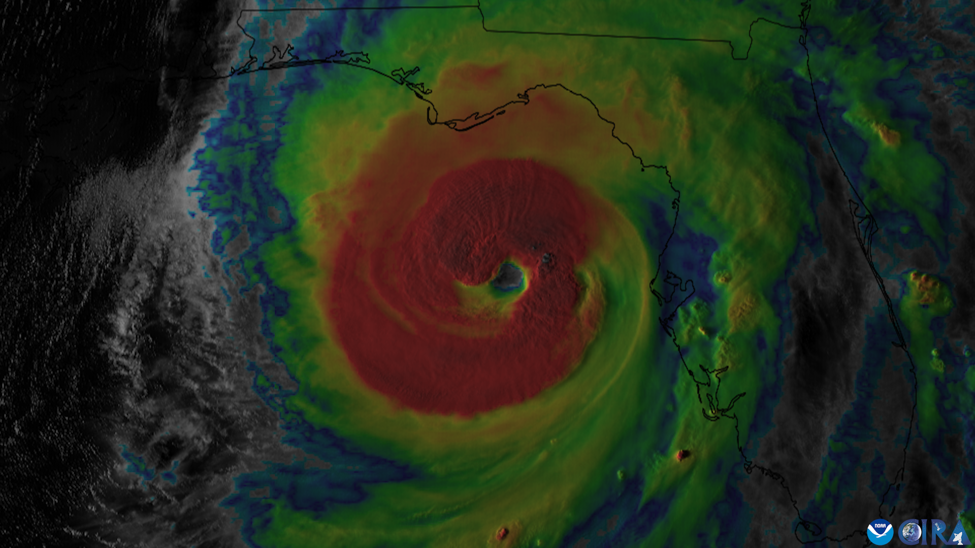
St. Johns County residents face another round of heavy rain, gusty winds and coastal flooding as Hurricane Isaias approaches the northern Gulf Coast, adding to concerns in neighborhoods already soaked by days of nor'easter conditions.
Isaias strengthened into a Category 2 hurricane Thursday, Oct. 8, with maximum sustained winds of 100 mph as of 5 p.m. EDT, according to the National Hurricane Center.
Forecasters expect the hurricane to make landfall along the northern Gulf Coast late Friday, Oct. 9, or early Saturday, Oct. 10. Additional strengthening is possible before landfall.
Although the storm's projected path remains west of St. Johns County, Northeast Florida faces additional periods of heavy rain, elevated tides and possible severe thunderstorms through Saturday, according to the National Weather Service in Jacksonville.
Days of persistent onshore winds and rainfall have already left some neighborhoods vulnerable to flooding. Saturated soil increases runoff, while elevated water levels in tidal waterways can slow drainage from low-lying streets and properties.
Palm Valley residents report flooded streets and slow drainage
Palm Valley residents experienced significant flooding Wednesday, Oct. 7, when Canal Boulevard remained underwater for much of the morning and afternoon. Nearby South Roscoe Boulevard also closed, complicating travel through the area, News4JAX reported.
Longtime resident Tab Baer said the water covered his property.
"You couldn't see one inch of land out here this morning," Baer told News4JAX. "That water was probably 4 to 5 inches over the whole property."
Baer estimated that the neighborhood received more than 10 inches of rain over several days. He also attributed the severity of the flooding partly to development that replaced natural wetlands.
He said water was draining slowly because elevated levels in the Intracoastal Waterway prevented the neighborhood's drainage system from discharging runoff efficiently.
By Wednesday evening, much of the water had receded from Canal Boulevard, although standing water remained in yards and along roadsides.
Conditions improved Thursday morning, but residents remained concerned about additional rainfall.
Palm Valley resident Trevor Rosendahl told News4JAX that the water came within about 5 feet of his garage, although it did not enter his home. He said the flooding was worse than what he experienced during hurricanes Irma and Matthew.
Coastal flood advisories and severe weather risk continue through weekend
The National Weather Service warned Thursday that persistent onshore winds and unusually high tides would continue producing minor to locally moderate tidal flooding in parts of Northeast Florida.
A coastal flood warning covered portions of the St. Johns River basin, while coastal flood advisories remained in effect for the Atlantic coast and Intracoastal Waterway through Saturday, Oct. 10.
Low-lying areas near tidal waterways, including parts of Palm Valley and communities along the Intracoastal Waterway, remain vulnerable to flooding during high tide




.jpg)